No elevation data
| Name: | No data |
| Distance: | No data |
| Minimum elevation: | No data |
| Maximum elevation: | No data |
| Elevation gain: | No data |
| Elevation loss: | No data |
| Duration: | No data |

Corno alle Scale is one of the highest peaks in the Tuscan-Emilian Apennines, with its 1,944 meters of height. Its summit offers a breathtaking 360 degree panorama over the entire Apennines, from the Tyrrhenian Sea to Lake Garda.
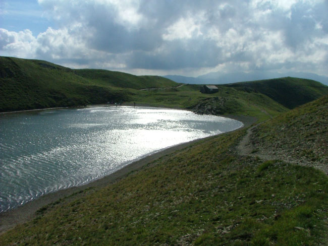
This itinerary allows you to reach the top of Corno alle Scale starting from Lake Scaffaiolo, a lake of glacial origin located at 1,780 meters above sea level. The route is approximately 8.5 km and has a medium difficulty, with some exposed sections.
The excursion starts from the Scaffaiolo Lake car park, located in Montepiano, in the municipality of Lizzano in Belvedere (MO). The car park is easily accessible by car from Pistoia, Bologna and Florence.
The path starts in the direction of Passo del Vallone (1,700 m), which can be reached in about 45 minutes. From Passo del Vallone, the path continues in the direction of Corno alle Scale, passing through the Balzi dell’Ora. The Balzi dell’Ora are an exposed stretch of path, which requires a steady step and an absence of vertigo.
After passing the Balzi dell’Ora, you reach the top of Corno alle Scale in about 30 minutes. The summit offers a breathtaking 360 degree panorama over the entire Apennines, from the Tyrrhenian Sea to Lake Garda.
The total altitude difference of the excursion is approximately 520 metres. The indicated travel times are:
From Lake Scaffaiolo to Passo del Vallone: 45 minutes
From Passo del Vallone to Corno alle Scale: 30 minutes
From Corno alle Scale to Scaffaiolo Lake: 2 hours
The route is of medium difficulty, with some exposed sections. The exposed sections are marked with cairns and ropes.
The recommended equipment for the excursion is the following:
Comfortable trekking shoes with good grip
Backpack with water bottle and snacks
Layered clothing, suitable for weather conditions
Hat, sunglasses and sunscreen
K-way or waterproof cape
The excursion can be done at any time of the year, but it is advisable to avoid the summer months, when temperatures can be high. In case of bad weather, it is advisable to abandon the excursion. Along the route there are some refuges where it is possible to refresh and stay overnight.