No elevation data
| Name: | No data |
| Distance: | No data |
| Minimum elevation: | No data |
| Maximum elevation: | No data |
| Elevation gain: | No data |
| Elevation loss: | No data |
| Duration: | No data |

The circular itinerary from Pian di Novello to Lago Nero is a challenging route, but one that offers breathtaking views of Tuscan nature.
The route starts from the car park of the Beatrice slope in Pian di Novello. From here, follow the forest road that goes up to the left, facing a first steep climb.
After about 3.2 km, you reach the Cascata del Doccione, a 20 meter high waterfall. Here you can make a short stop to admire the view.
Continuing along the road, you reach the Pian di Novello forest botanical garden. Here you can observe a rich variety of native plants and flowers.
After approximately 7.9 km, you reach the Ponte delle Seghe, a medieval stone bridge.
After crossing the bridge, continue along the road to the shepherds’ house, an ancient stone building that served as a shelter for shepherds.
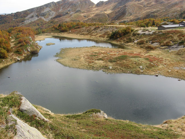
From here, continue along the path that leads to Lago Nero, a natural lake of glacial origin. The lake is surrounded by a dense beech forest, which creates a suggestive atmosphere.
From Lago Nero, it is possible to continue towards Monte Poggione. The path climbs to the left, facing a series of hairpin bends. After about 2.8 km, you reach the Foce di Campolino, a pass that separates the Serchio and Lima valleys.
From Foce di Campolino, continue along the path that climbs towards Monte Poggione. The path is partly on the ridge, with some exposed sections. The view from the top of the mountain is breathtaking.
To return, follow the path that descends to the left, in the direction of Pian di Novello. The path is the same as the outward journey, but in reverse.
The itinerary is of moderate difficulty, but requires good physical training. The first part of the route is flat or slightly uphill, while the second part is more challenging, with steep climbs and exposed sections.
Advice
It is advisable to wear comfortable trekking shoes suitable for the terrain.
You must bring enough water and food with you.
It is advisable to pay attention to the white-red signs of the path, especially at the end of the small Canyon which is found going up towards Foce di Campolino.
ROUTE STATISTICS
Distance: 18.49 km
Positive altitude difference: 915 m
Technical difficulty: Medium
Maximum altitude: 1,830 m
Type of route: Ring